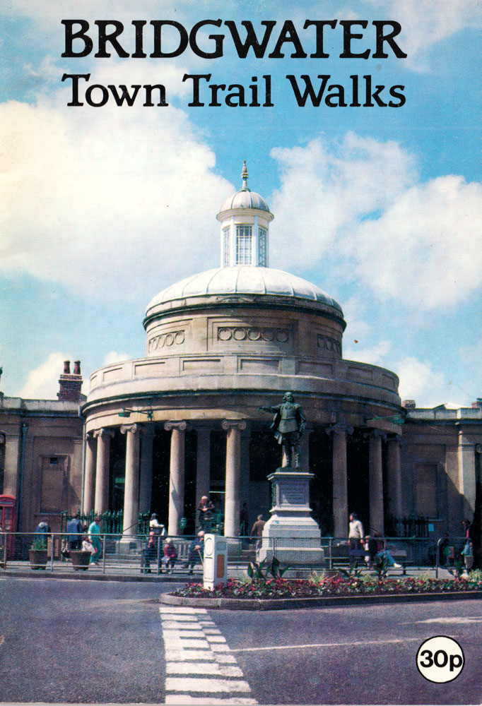
Bridgwater Town Trail Walks
This Guide is a joint publication by Sedgemoor District Council and the Bridgwater & District Civic Society, and is intended to give a description of some of the buildings and items of interest to be seen in and around the town centre. There are two trails, each of which will take between 1 – 1 1/2 hours to complete. Both trails start at the Cornhill, in the centre of the town and incorporate King Square and Castle Street at which point they split into the RED TRAIL and the BLUE TRAIL. The RED TRAIL encompasses the riverside and docks area and concentrates on interesting features from Bridgwater’s industrial past.
The BLUE TRAIL confines itself to the town centre and highlights, in particular, individual buildings and features of architectural or historic interest.
A description of the trails is preceded by a brief history of Bridgwater. A map showing the route of the trails is to be found in the middle pages, and at the end of the booklet is a glossary of the architectural terms used in the description of the buildings. A map of these trails, to a larger scale than that included in the centre page of this booklet, is on display by the Civic Society on the side of Lloyds Bank at the Cornhill, Bridgwater.

Brief History of the Town
A community has existed here in Bridgwater for about 1,000 years. During this time the town has inevitably undergone many changes having developed and evolved in parallel with cultural, economic and technological improvements.
The siting of a settlement where Bridgwater now stands arose from the existence of an area of slightly raised land extending towards the west bank of the River Parrett. This area was less liable to flooding than the surrounding moors and formed a convenient site for a river crossing.
Listed in the Domesday Book as an agricultural community called Brugie, the town developed around the river crossing and began to function as a river port and commercial centre. A castle was built on the west bank of the river, by William de Bruere, construction commencing at about the time the town gained Borough status in 1200.
By the fifteenth century the town had grown to about 300 houses and had become a thriving port. The cloth trade was by this time well established and was the mainstay of the prosperity of the town, with much exporting of woollen cloths from various parts of Somerset.
The town itself, however, suffered grievously in the Civil War when it was the scene of a major siege. In three days at the end of July 1645, Parliamentary artillery pounded the town destroying virtually all the domestic and commercial buildings which at that time were mostly timber framed. The castle was subsequently destroyed by the Roundheads as a reprisal for the town’s resistance and the site lay derelict for almost a century.
The cloth trade enjoyed a further boom in the first quarter of the eighteenth century, although later declined as the industrial revolution moved the centre of activity northwards towards the sources of cheap power. As the importance of Bristol overshadowed the port of Bridgwater, the town declined into a long period of stagnation.
The increase in the commercial manufacture of roofing tiles and bricks, and the improvements to the communications network were major factors shaping the growth of the town in the nineteen. century. As with many towns, Bridgwater’s railway station was some distance from the town centre and this resulted in a tendency for the town to grow eastwards towards the railway. This factor, together with the constraints imposed by clay workings and low-lying land to the north and south of the town centre, has been largely responsible for the east-west growth of the town.
During the twentieth century the local brick and tile industry gradually succumbed to competition from concrete roof tile manufacturers, and the economic base of the town has now shifted to a wider range of manufacturing industries.
Since 1974, Bridgwater has been the administrative centre of the District of Sedgemoor. The population of the town has grown from about 15,000 at the turn of the century to approximately 30,000 today, resulting in large scale suburban development to the east, south and west of the town centre.
Bridgwater has not experienced the scale and rate of comprehensive redevelopment that has altered the face of many other towns in recent years. The older parts of the town centre have retained much of their character created by the historic buildings and mediaeval street pattern and it is in these areas that the town trails are concentrated.
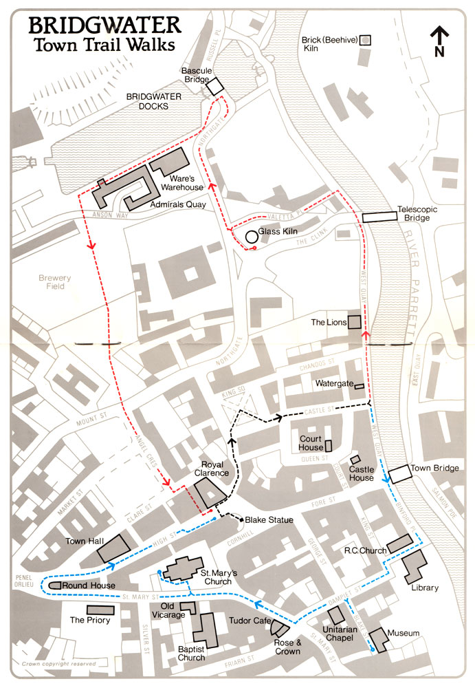
The Town Trails
START AT THE CORNHILL. This is the historic centre of the town; it was the site of the mediaeval market place where a hexagonal cross once stood. The existing Cornhill Building (1826) gives a fine emphasis to the town centre. Note the decorative pineapple at the top of the dome structure.
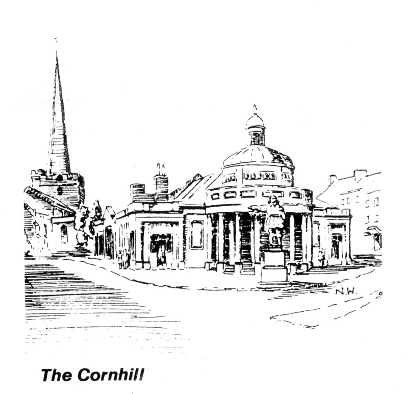
The bronze statue depicts Admiral Blake, famous as Oliver Cromwell’s Chief Admiral. The plaques mounted on the granite pedestal illustrate Blake’s victories at sea and the return of his body to Plymouth in 1657.
Along Fore Street, you will see several fine four-storey buildings in ‘Renaissance style’ with elaborate window mouldings and quoins. Most of the buildings date from the first half of the nineteenth century. Looking to your left on the corner you will see the Royal Clarence Hotel building (1825) a splendidly proportioned Regency style building. The plaque over the portico is a casting based on the old seal of the Borough of Bridgwater taken from the first iron bridge over the River Parrett (1795), which was demolished and replaced by the present bridge in 1883.
CROSS HIGH STREET AND PASS BETWEEN THE POST OFFICE AND THE NATIONAL WESTMINSTER BANK, PROCEED TO KING SQUARE.
This narrow road marks the site of the Castle Bailey, the town entrance into the area once occupied by Bridgwater Castle. On the way, pause to see the nineteenth century buildings on the right. Of particular note is the dental surgery which has several interesting features including railings with incorporated footscrapers and gates. Also note the lion’s head guttering, at roof level.
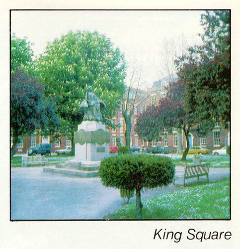
ARRIVING AT KING SQUARE you will see that two sides are of early nineteenth century origin, with the third largely of much more recent construction (1976) built to imitate the other facades. The older buildings have much finer architectural detailing with railings and some of the original balconies still remaining.
In the centre of the square is the World War Memorial erected in 1924. The seated statue of a mother with her children is intended to represent civilisation. Under her feet are the tiny figures of Strife, Bloodshed, Corruption and Despair. In her hand she holds the World and in her lap, the Book of Law.
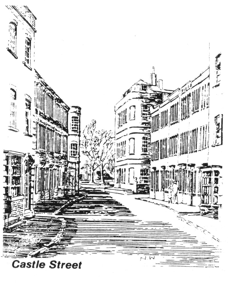
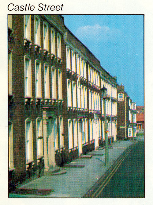
PROCEED INTO CASTLE STREET which is acknowledged as one of the finest Georgian Streets in the South-West. The street was the project of James Brydga, First Duke of Oiandos and work was begun on it in 1723 on the derelict site of the former Bridgwater Castle (1216) which had been destroyed some eighty years previously in the Civil War.
The buildings in Castle Street are early Georgian. Some of the sash windows are original, these being distinguishable by their wider glazing bars. The street was obviously conceived as a whole, a speculative development for merchants of that time, its charm being illustrated by such subtleties as differing window surrounds and differing decorative doorways.
On the right hand side, No. 11 Castle Street, is the Arts Centre and was, in 1946, the first such centre in the country to be opened by the then predecessor of the Arts Council of Great Britain.
Near the bottom of Castle Street, A SHORT DETOUR FROM THE TRAIL TO THE RIGHT ALONG QUEEN STREET reveals an unusual, if not particularly attractive building. Castle House is a folly constructed in 1851 by a local businessman. It was probably designed to show the latest innovations in precast concrete, and as such was way ahead of its time in the use of new building materials. You will see that a variety of shapes and textures are utilised and also the painted statue of Napoleon.
Opposite is The Courthouse, built in the early nineteenth century and presenting a classical facade constructed of Bath Stone.
RETURN TO CASTLE STREET AND PROCEED TO ITS JUNCTION WITH WEST QUAY.
The trail now divides. The RED TRAIL takes you around the Docks area, whilst the BLUE TRAIL confines itself to the tout» centre. Both trails take about the same time to complete.
Red Trail – Bridgwater Docks
TURN LEFT AND WALK ALONG WEST QUAY. This area was once the centre of shipping activity in the town. Wharves originally extended downstream for about a mile, remnants of which can still be seen. The River Parrett was navigable for boats of up to 400 tons although the wide tidal range meant that for much of the time no ship of more than 100 tons could approach the town until the next spring tide. Apart from having to wait in the estuary for the tide, another difficulty was the need to employ `hobblers’ who manually pulled the ships in to port, often for up to two miles.
A short distance along West Quay, pause to view the mediaeval Watergate of Bridgwater Castle. The archway is set back from the Quay down a passage between Nos. 11 and 12 and was used to bring in supplies from the River. Parts of the castle wall are still evident in this area and are around 12 feet thick.
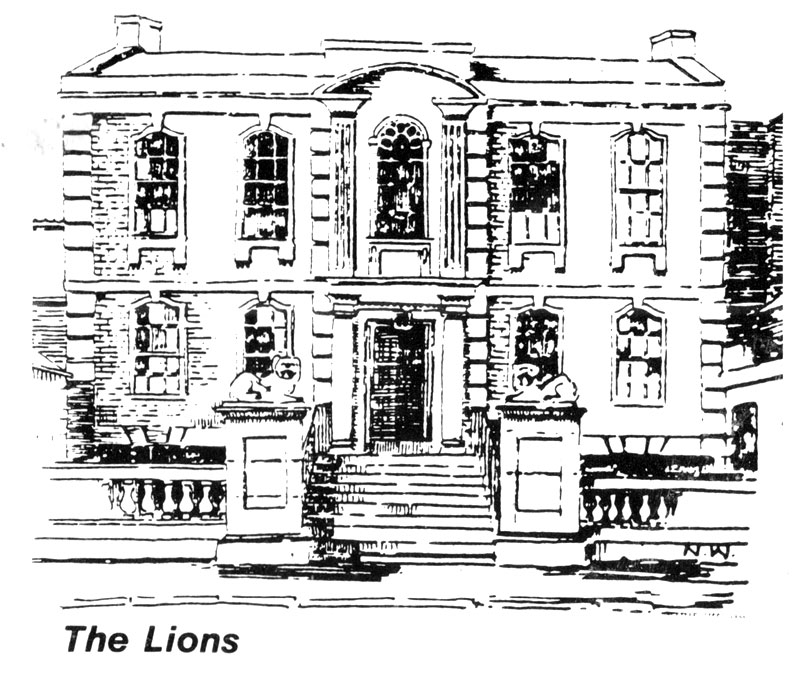
CONTINUE ALONG WEST QUAY until you arrive at the Lions Building (c1720), regarded by many as the finest domestic building in Bridgwater, once the home of Benjamin Holloway, the builder commissioned by the Duke of Chandos for the construction of Castle Street.
CARRY ON TO THE BLACK BRIDGE which was constructed in 1871 to carry the railway across to the Docks. It originally functioned as a telescopic bridge and could be withdrawn to the east bank to give a clear passage for boats on the river. Much of the operating mechanism has since been removed and the bridge is now permanently fixed. The bridge was opened to road traffic in 1983 when the new distributor road was completed.
CROSS THE ROAD AT THIS POINT AND WALK AS FAR AS VALETTA PLACE. From here look across the river and you will see the last remaining complete Beehive Kiln (late nineteenth century), a reminder of Bridgwater’s once thriving brick and tile industry.
TURN AWAY FROM THE RIVER AND WALK ALONG VALETTA PLACE FOLLOWING THE FOOTPATH WESTWARDS. Valetta Place is an attractive terrace of mid/late nineteenth century red brick houses with interesting curved brickwork between Nos. 4 and 5.
AT THE JUNCTION OF VALETTA PLACE AND NORTHGATE ON THE LEFT HAND SIDE you will see the remains of the Chandos Glass Kiln (1726). The Kiln was originally used for making glass although for much of its working life was used for firing pottery. The remains are now listed as an ‘ancient monument’, although the kiln originally stood 125 feet high, was 75 feet wide at the base and measured 6 feet across at the top. It remained a prominent feature of the town until 1942, when it was demolished to provide hardcore for wartime Westonzoyland airfield. The remains are very important as they represent one of the earliest industrialised enterprises in the region.
AT NORTHGATE TURN RIGHT ALONG THE ROAD TOWARDS THE DOCKS. The Docks, which were designed by engineer, Thomas Maddicks, were completed in 1841, in order to overcome the problems of the tidal range in the river. The constant level of water was crucial for an efficient turn around of shipping as it ensured loading and unloading irrespective of tidal conditions. This enabled over a quarter of a million tons a year to pass through the docks in the 1880s.
ARRIVE AT THE BASCULE BRIDGE AND LOOK TO YOUR RIGHT.
The Bascule Bridge was originally built in 1841, although the present bridge was subjected to major alterations in the early part of this century. The bridge has recently been completely restored by Somerset County Council and was re-opened to traffic in 1983. The white boxes contain the operating mechanisms which lift each section of the bridge by the use of manual labour.
The Tidal Basin, as its name implies, was the controlling tank between the tidal River Parrett and the main Dock. You will notice various other operating mechanisms around the tidal basin which controlled a complicated system of paddles and channels used to sluice out silt which accumulated in the Dock. The scraper boat, `Bertha’, now at the Exeter Maritime Museum, assisted in pushing silt to the centre of the basin. The silt could then be flushed into the river.
There are two locks between the tidal basin and the River. The Barge Lock was built for the passage of smaller craft and could be used at most states of the tide. The lock gates to this chamber were rebuilt in 1984, so that the lock can be used by pleasure boats. The Ship Lock, the larger of the two exits to the river is now sealed but originally had only one set of gates so that the whole tidal basin then acted as a lock chamber. As with most features at the Dock, the gates were opened and shut with manual labour.

WALK ALONG THE SOUTH SIDE OF THE DOCK BASIN, KEEPING THE WAREHOUSE ON YOUR LEFT.
The main ‘floating harbour’ was opened on 25th March, 1841. It is 190 metres long and 65 metres wide and some 105,000 cubic metres of soil were excavated by the very considerable workforce during the three years the Docks took to build. The Mump or mound on the north side of the floating harbour is the result of the tipped earth that was excavated.
Ware’s Warehouse (1841) was built in phases: the three western (right-hand) bays formed the original bonded warehouse of the Canal Company; the remaining portion was added by the Bristol and Exeter Railway Company.
From this heyday in the late nineteenth century, the Docks went into a steady decline until they were fatally closed by the owners, British Railways, on 31st July, 1971.
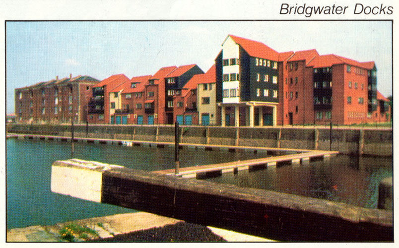
The Docks area is now being completely refurbished for use as a Marina. Ware’s Warehouse, converted to contain residential flats, accommodation for marina interests and a public house/restaurant, has been recently renamed `Admiral’s Landing’.
CONTINUE ALONG THE DOCKSIDE PAST THE FIRST HOUSING BLOCK. The `Admiral’s Quay’ housing development has been designed to complement Ware’s Warehouse and the Docks Area and is being built in five phases, totalling about 130 houses and flats.
AFTER THE FIRST BLOCK OF HOUSING TURN LEFT, CROSS THE ROAD, AND FOLLOW THE FOOTPATH ACROSS THE PLAYING FIELD AND CAR PARK.
The car park marks the site of the former Starkey, Knight and Ford Brewery which was taken over by Whitbreads before closure and eventual demolition. A spur from the Dockside railway used to cross what is still called the Brewery Field from the Docks to the Brewery. Many buildings in the town still bear the sign of a horse, the trademark of the old Brewery Company.
CROSS THE ROAD AND WALK ALONG ANGEL CRESCENT.
The junction of Angel Crescent and Mount Street marks the site of the old `North Gate’ entrance to the town. The three-storey buildings forming Angel Crescent were built c1816 with their plan slightly curved in the centre. The buildings were formerly residential properties and are being completely refurbished for suites of offices.
On the right hand side of Angel Crescent is the site of the Angel Place Shopping Centre, a major new development which is to provide a covered shopping precinct and parking for 400 cars. The new centre is due to open in 1986/7.
WALK THROUGH THE AVENUE AND RETURN TO CORNHILL which marks the end of the Red Trail.

Blue Trail – Town Centre
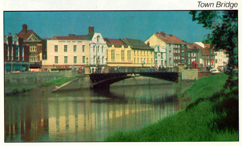
TURN RIGHT AND WALK TOWARDS THE TOWN BRIDGE. The River Parrett was central to Bridgwater’s function as a port with both West and East Quays once being the focus of shipping activity. Wharves originally extended downstream for a considerable distance, remnants of which can be seen on the east bank. A number of former warehouses survive and on East Quay the building now occupied by Lalonde’s was formerly the Temperance Hotel. Immediately to its left was the town’s Post Office which moved to High Street and subsequently to Cornhill in 1909.
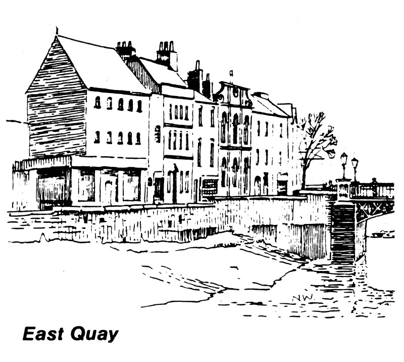
In the vicinity of what is now the East Quay Medical Centre there was once a dry dock for ship building. Closer to the Town Bridge was a grillage which supported craft at low tide so that they could be cleaned. At that time the Quay steps and slipways had to be constantly hosed to keep them clear of silt. The silt taken from the river was used for making Bath Bricks, which were sold nationally for scouring and cleaning before modern cleansing materials became available.
West Quay still retains the character of a quayside, the wall, steps and railings having been recently raised (1983) as part of the water authority’s flood prevention scheme for the town.
The Fountain Inn at No. 2 West Quay is a late 18th century building showing Dutch influence in its high gable. Next door, the Bristol and West Building Society was formerly the Punch Bowl Inn which was erected in 1795.
The Town Bridge was opened in 1883 and cost £3,214 to construct. The bridge contains 93 tons of wrought iron and 15 tons of cast iron and was designed by Mr. R.C. Else and Mr. G.B. Laffan. It superseded an iron bridge which had been built in 1795 after the former three arched stone bridge had been pulled down because it was too narrow to accommodate the growing volume of traffic.
In 1983, replicas of the original Town Bridge lanterns were installed in commemoration of its centenary by the Bridgwater and District Civic Society. Look up Fore Street. The street pattern survives from mediaeval times and its narrowness accentuates the impression of commercial activity. The buildings are predominantly 19th century, mostly of 3 and 4 storeys and range in style from simple brick to more flamboyant ashlar stone facades. On the right hand side note No. 4 – 6 Fore Street, with an Edwardian facade in two shades of terra-cotta blocks and unusual chimneys ornamented by projecting snake heads.
CROSS THE ROAD AND WALK ALONG BINFORD PLACE. Note the view of Salmon Parade across the river with the attractive waterside group of early 19th century cottages and the Bridgwater Hospital building, parts of which date from 1813.
Numbers 8 and 9 Binford Place are examples of two fine early nineteenth century town houses. Note the interesting Lion Mask door knocker on No. 9 and thesegmental iron balconies fronting the first floor windows.
FOLLOW THE ROAD ROUND TO THE RIGHT INTO CHAPEL STREET. The Bridgwater Library (1905) is based on an octagonal building with a parapet and dome and has since been adapted and extended. In front of you is the former Wesleyan Chapel (1816) which had a columned portico extension added in 1860, as the inscription indicates. The building is now used as a retail furniture warehouse.
BEAR LEFT INTO DAMPIET STREET. In mediaeval times the street was known as Damyet Street although the buildings on the south side are examples of pleasantly simple town houses dating from the early 19th century.
TURN LEFT INTO BLAKE STREET. At the end of the short street on the left is one of the town’s oldest buildings, known traditionally as the birthplace of Robert Blake (born 1598). Now the Town Museum, the roof timbers suggest the building dates from about 1500. However, it was substantially rebuilt in the early nineteenth century which, together with other subsequent alterations, conceals its true age.
The Town Museum contains collections of exhibits illustrating the archaeology and local history of the town and neighbourhood. The town’s connection with the Monmouth Rebellion, the Battle of Sedgemoor and the career of Admiral Blake are well represented.
At the end of the street, Durleigh Brook is visible in a deep culvert. The brook marks the line of the old Town Ditch, and the building through which it flows is an Old Mill which was used for grinding corn for the castle until the seventeenth century. The building contains the remains of a spindle and old stone walls beneath the existing nineteenth century structure.
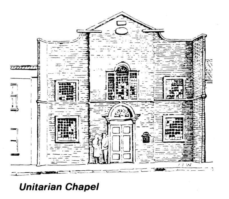
RETRACE YOUR ROUTE AND TURN LEFT INTO DAMPIET STREET. On your left is the Unitarian Chapel, the oldest non-conformist church in the town, built in 1688 with the frontage altered in the following century. The building has a fine shell hood entrance porch on carved console brackets to the doorway. Inside are the original boxed pews in a simple, well proportioned interior where the poet Coleridge preached in the years 1797 and 1798.
TURN RIGHT INTO ST. MARY STREET. The Rose and Crown public house was originally a mediaeval house, probably of the 14th century, although very little is left of the original. Next door, the Tudor Cafe is not as old as its name suggests, the facade being clad in ‘imitation’ half timbering. However, the original house dates from about 1600 and evidence of original panelling, plaster friezes and fireplaces can still be seen inside.
PROCEED ALONG ST. MARY STREET passing Number 39 which, by tradition, is the house where Judge Jeffries lodged during the trials at the ‘Bloody Assize’ which followed after the Monmouth Rebellion (1685). The West Country paid heavily for its support of the Duke a Monmouth in his unsuccessful attempt to overthrow King James II from the throne of England. Some 300 executions took place and more than 800 prisoners were transported on the orders of Judge Jeffries.
The Waterloo House at N. 41 is a fine early 18th century building in a style reminiscent of Castle Street and with an attractive street level frontage.
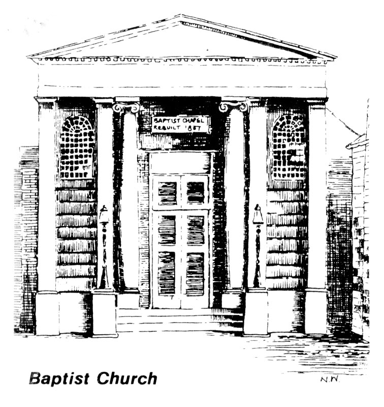
The nearby Baptist Church, set back behind its open forecourt, was built in 1837 to replace an earlier place of worship. It has a fine Classical style pediment surmounting Ionic columns.
The Old Vicarage Restaurant is believed to have been the mediaeval vicarage for the Parish Church. The building is one of the oldest in the town, being basically 16th century in origin and retaining some original walls and roof timbering. Well preserved parts of the original wattle and daub walls are to be seen on the left side of the entrance to the hotel courtyard.
St. Mary’s Church, the parish church of Bridgwater is worthy of a special visit. The oldest part of the Church is its 13th century tower with spire built later in 1367. Internally, it has a fine Jacobean screen to the pews for the former Bridgwater Borough Mayor and Councillors. Victorian reconstructions to the roof have retained the Church’s character, although the Victorian introduction of the large eastern window is rather less fortunate. Behind the altar is a fine painting by an unknown artist, unusual because Christ is portrayed beardless.
Before leaving the Churchyard, glance to the rear of the various High Street premises which still retain much of their original facades, unaltered by trends in shopfront fashions which have affected their frontages.
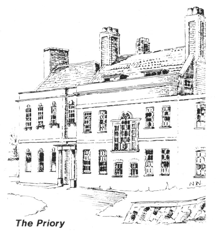
CONTINUE WESTWARDS, ALONG ST. MARY STREET. On the left is The Priory, originally an 18th century town house, with its roadside frontage much altered but retaining the original doorway entrance. The building is now used as Sedgemoor District C,ouncil offices. The rear garden facade is interesting, with various alterations and additions apparent, but it retains mu. of its original elegance. The Palladian style window was inserted at about the same time as the western end’s original music room and columned entrance were added.
CONTINUE TO PENEL ORLIEU. Two mediaeval streets, Pynel Street and Orloue Street merged here from which the strange name of this junction has been derived. A pig market used to be held here which was marked by a single shafted cross, subsequently removed in the mid 1800s.
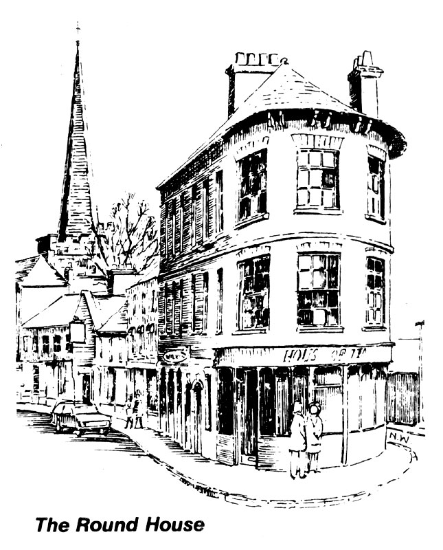
TURN RIGHT INTO HIGH STREET. Marking the end of High Street is a block of mid 1.h century properties having an elegantly curved end known locally as The Round House. Across the road is the Valiant Soldier, previously named the ‘Market House Inn’ because of its proximity to the old pig and cattle market sites. It was rebuilt in the 19th century with an altered exterior, but some of the internal features (and the 1583 datestone over the door) have been salvaged.
CONTINUE ALONG HIGH STREET. On the facade of Oliver’s foodstore note the sign of the horse, the trademark of the now defunct local Starkey, Knight and Ford Brewery which once operated this building as a public house.
At 46 High Street, Wade’s Food and Wine Bar derives As name from a Major Nathaniel Wade (1666 – 1718) who was commander of the Duke of Monmouth’s Red regiment during the 1685 rebellion.
The Town Hall on the north side of High Street is a very large 3 storey building with a stucco front in late Georgian style and was built in 1865 by C. Knowles.
In walking frosts High Street back to Cornhill and Town Trail’s starting point, none of the buildings can be considered architectural masterpieces. However, the charm of the street lies in its mixture of predominantly early 19th century buildings, shortly to be punctuated at Numbers 20 – 26 by the entrance to the new Angel Place Shopping Centre. This wider part of High Street was originally cut in two by a central island of narrow buildings, believed to have been demolished in the early 19th century.
The sign above 25 High Street records the name of E.H. Hooper, Cash Drapers, Silk Mercer, Millinery and Mantles established in 1875. The sign in gold leaf on green behind glass is in a fine state of preservation.
RETURN TO CORNHILL, the end of the Blue Trail.
Glossary of Architectural Terms
Ashlar: Square cut smooth stonework. Stone walls or facings finely dresssd and laid in courses with thin joints.
Classical: A style adopted following the Renaissance, inspired by the forms of ancient Greece or Rome.
Console Bracket: Elaborate bracket, usually with an S-shaped scroll.
Edwardian Period: Architecture of thc rsign of Edward VII (1901 – 1910).
Georgian Period: Architecture of the reigns of the first four Georges (1714 – 1830). Georgian architecture is often classical in its major buildings, but on smaller, domestic scale buildings, it is very simple with relatively plain, well-proportioned facades.
Ionic Column: One of the styles of columns used by the Greeks and Romans. Columns of thc Ionic Order are distinguished by the upper part of the slum which is ornamented with two pairs of spiral projections or volutes. Of the period of the reign of King James I at the beginning of the
Jacobean seventeenth century. The term applies to a crude English Renaissance style following Tudor and Elizabethan domestic architecture.
Palladian : A style of architecture that was derived from the ideas of Palladio (1508 – 1580). The style is characterised by harmonic proportions, symmetry and good taste.
Pediment: In classical architecture a low pitched gable sera portico and often containing sculpture in larger structures.
Portico: A roofed space, open or partially closed, forming the entrance to a building.
Quoins : The dressed stones at the corners of buildings, usually laid so that large and small faces alternate.
Regency Style: Early nineteenth century period of architecture which evolved from the Georgian period and was usually marked by a grander building style.
Renaissance Style: Italian Art and Architecture from the fifteenth and early sixteenth centuries. English Renaissance Style architecture is often characterised by the use of motifs and straight verticals and horizontals, especially in the design of windows.
Stucco: A term originally used to describe all plasterwork, but now confined to smooth plastering of the outside wall.
Wattle and Daub: A method of wall construction consisting of branches (wattles) roughly plastered over with mud or clay (daub).
Acknowledgements
Acknowledgement is made to the assistance given by the following in the production of this booklet:-
- The Somerset Branch of the Royal Institute of British Architects which has contributed towards the cost of producing this booklet in commemoration of the 1984 Festival of Architecture.
- Jack Lawrence, for assisting in checking the historical accuracy of the text.
- Neil Widgery, who kindly provided the black and white sketches.
- Cover Photograph: Douglas Allen Printers and Colour Separations: K.W.Coray & Son 683851
- Published by: Sedgemoor District Council in conjunction with the Bridgwater and District Civic Society
- The plan in this publication is based upon the Ordnance Survey Maps with the permission of the Controller of H.M. Stationery Office. Crown Copyright Reserved.
- The trails shown in this booklet do not necessarily indicate a public right of way.
May 1984

